
Meesapulimala Trek: Complete Guide to Route, Best Time, Permits and Camping

Meesapulimala rises to 2,640 m (8,661 ft) in the Idukki district, near Munnar. Kerala Tourism describes it as the second-highest peak in the Western Ghats after Anamudi, and it is one of the few places in Kerala where you can stand above a sea of clouds on an ordinary winter morning.
The name comes from Malayalam: meesa (moustache), puli (tiger) and mala (hill). The trek is run by the Kerala Forest Development Corporation (KFDC), so every group walks with a forest guide on a booked slot. This guide covers the route, difficulty, best season, stay options, permits and packing, so you can plan the trip in one place. Details that change, such as KFDC rates, slot availability and trail closures, should always be confirmed for your date.
Meesapulimala trek at a glance
- Altitude: 2,640 m (8,661 ft)
- Location: Near Munnar, Idukki district, Kerala
- Managed by: Kerala Forest Development Corporation (KFDC)
- Starting point: KFDC base camp, about 24 km from Munnar by 4×4 jeep
- Trek distance: About 8 to 10 km return from Rhodo Valley, the last point a jeep can reach
- Time on the trail: 6 to 8 hours, depending on pace and weather
- Difficulty: Moderate. Long, with steady climbs, but no technical sections
- Best time: September to February
- Permit: A KFDC slot and forest guide are required for every trekker
The Meesapulimala trek route, section by section
Munnar to base camp (about 24 km by jeep)
Groups report in Munnar and ride 4×4 jeeps through Mattupetty and the Aruvikkad tea estate to the KFDC base camp, which sits at about 6,000 ft. The final stretch is a rough estate track that only licensed off-road jeeps drive, and the ride through the tea gardens is an adventure in itself.
Base camp to Rhodo Valley (about 4 km)
A jeep track continues through pine and grassland to Rhodo Valley, named after the wild rhododendrons on its slopes. This is the last point vehicles can reach and the natural break before the climb.
Rhodo Valley to the summit
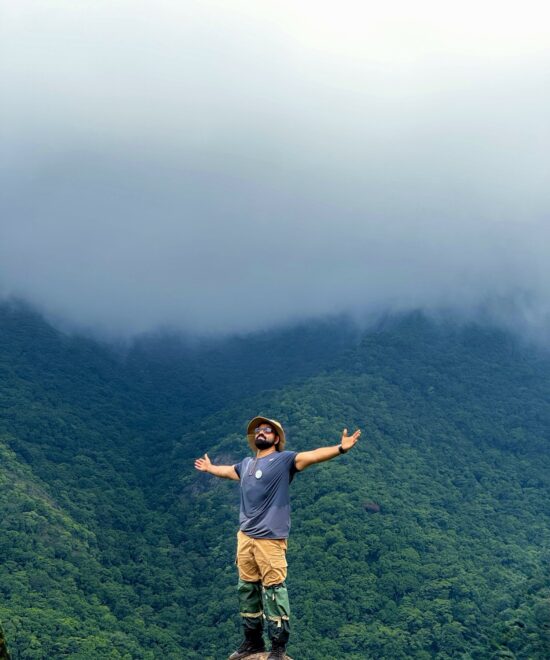
From here you walk. The trail crosses a chain of grassy hills, with pockets of shola forest in the folds between them, and each hill feels a little steeper than the last. The top is a broad grassy crest. On a clear morning you can see Anamudi, the tea estates of Kolukkumalai and the plains of Tamil Nadu far below. Clouds often rise from late morning, so groups aim to reach the summit early and start down before the mist closes in. The descent follows the same way back, and the grass slopes get slippery after rain.
What about the Kurangani route?
A longer trail climbs from the Tamil Nadu side through Kurangani and Kolukkumalai. Access on that side is controlled separately and has been heavily restricted, so check its status before planning it. KeralaTrekking treks use the Kerala route through KFDC. For distances and photos of each section, see this Meesapulimala route and difficulty guide.
How difficult is the Meesapulimala trek?
Meesapulimala is a moderate trek. There is no rock climbing and no technical section, but it is a long day of ups and downs in full sun on open grass, with strong wind near the top. Active beginners, regular walkers and fit teenagers usually manage it well. If you have knee, heart or breathing concerns, talk to your doctor and tell your organiser while booking.
Three to four weeks of brisk walks, stairs or short hill walks with a light backpack make a real difference. This simple 4 week fitness plan is a good place to start, and first-timers should read 10 things to know before your first Meesapulimala trek.
Best time to trek Meesapulimala
- September to November: The hills are at their greenest and the streams run full. Afternoon showers are common, so mornings are your window. November is peak season.
- December to February: Clear skies, dry trails and the best long views. Nights at base camp get properly cold. Christmas, New Year and long weekends fill first.
- March to May: Warmer days and hazier views. This is forest fire season in Kerala, and forest authorities sometimes restrict treks.
- June to August: Heavy monsoon rain, wind, thick cloud and leeches. KFDC may suspend treks, and we suggest picking another season.
For a month-by-month view, read the best time to visit Meesapulimala or our guide to the best time to trek in Kerala.
Neelakurinji on Meesapulimala
The high grasslands around Munnar are Neelakurinji country. These shrubs flower together roughly once every twelve years, and different hills bloom in different years. In 2026, Neelakurinji flowered across parts of the Munnar hills, including Chokramudi. The bloom is natural, so density changes with rain and weather and cannot be guaranteed on any date or hill.
Our seasonal Purple Trail: Meesapulimala special trek is a one-day trip with pickup and drop at Aluva. We share the latest trail report on WhatsApp before you pay.
Day trek or overnight camping?
You can do Meesapulimala as one long day or split it over two days with a night in the forest. All overnight stays are run by KFDC, and which ones are open can change by season.
- Base camp tents: The classic option, with a shared dining area, basic toilets and a campfire. Kerala Tourism lists a maximum of 40 people a night, so weekends fill first.
- Rhodo Mansion: A simple stay in Rhodo Valley, protected by an elephant trench. Sleeping here shortens the summit day.
- Sky Cottage: A small cottage on a cliff facing a waterfall and the Anamudi hills. It takes only three guests and is the hardest stay to get.
An overnight stay gives you a fresh start at dawn and a better chance of a clear summit, which is why we recommend it for first-timers and families. A day trek suits fit trekkers who are short on time. Read more about camping and stays at Meesapulimala.
Meesapulimala permits and booking
You cannot walk in from the estates on your own. Every trekker needs a KFDC slot, and a forest guide walks with every group. You can book directly with KFDC Ecotourism in Munnar or through an organiser who books the slot, jeep and guide for you. Carry an original government photo ID on the day.
Our Meesapulimala permit and KFDC booking guide explains each step, the documents you need and how cancellations work.
What to pack
The summit can feel several degrees colder than Munnar town, with wind that cuts through a single layer, while the open grass gets strong sun by mid-morning. Pack in layers: a windproof jacket, a warm layer, a cap, sunscreen, 2 litres of water and trekking shoes with good grip.
See the full Meesapulimala trek packing list, or build a tickable list in two minutes with our free trek packing checklist generator.
How to reach Munnar
- By train: Aluva is the nearest major railway station, about 109 km from Munnar. Ernakulam is about 126 km away.
- By air: Cochin International Airport is about 108 km from Munnar.
- By road: From Kochi, the usual route runs via Kothamangalam and Adimali. From Bengaluru, overnight buses run to Munnar.
Most trek days start too early to arrive in Munnar the same morning, so plan to reach the night before. Read how to reach Meesapulimala, or the trip plans from Kochi and Bengaluru.
Trail rules
- Trek only with the assigned forest guide and follow their instructions on route and timing.
- No alcohol, smoking or loud music inside the forest.
- Carry every wrapper and bottle back down. Leave no single-use plastic behind.
- Do not pick or damage Neelakurinji or any other plant.
- Keep a long distance from wildlife and never feed animals.
- The guide can turn a group back for weather or safety, and that call is final.
Meesapulimala trek FAQs
Can I trek Meesapulimala without a guide?
No. The trek is inside KFDC-managed forest land, and every group walks with a KFDC forest guide on a booked slot.
How long is the Meesapulimala trek?
The walk from Rhodo Valley to the summit and back is about 8 to 10 km and takes 6 to 8 hours. Exact distance depends on where your group starts walking and the line the guide takes on the day.
Is Meesapulimala good for beginners?
Yes, for active beginners. It is long rather than technical. A few weeks of walking practice and an overnight plan make it much more comfortable.
Will I see wildlife?
The grasslands are home to the Nilgiri tahr, the mountain goat found only in the Western Ghats, and gaur and elephants also move through the area. Sightings are never guaranteed. Learn more about the wildlife of Meesapulimala.
Is there mobile network on the trek?
Network is weak or absent at base camp and on the trail. Charge your phone and power bank in Munnar.
Trek Meesapulimala with KeralaTrekking
We handle the KFDC slot, jeep, forest guide and our own trek lead, so you only need to reach the starting point.
- Meesapulimala Trekking and Camping, Munnar (2 days, 1 night)
- The Purple Trail: Meesapulimala special day trek from Aluva
- Call or WhatsApp: +91 88489 27969 or +91 88482 25820
Related reads
- Meesapulimala trek permit and KFDC booking guide
- Meesapulimala trek packing list
- Trekking in Kerala: 14 trails into the Western Ghats
- Trekking permits in Kerala: what every trekker should know
Source for KFDC distances, stays and capacity: Kerala Tourism, Trekking in Munnar. KFDC programmes can change, so confirm details for your date.

One thought on “Meesapulimala Trek: Complete Guide to Route, Best Time, Permits and Camping”
Add a Comment Cancel reply
Recent Posts

Best Treks Near Kochi: 8 Trails for a Day or Weekend

Best Treks in Wayanad: 4 Trails Worth the Climb


Thank you for sharing superb informations. Your website is very cool. I am impressed by the details that you?¦ve on this website. It reveals how nicely you perceive this subject. Bookmarked this web page, will come back for more articles. You, my friend, ROCK! I found simply the information I already searched everywhere and just couldn’t come across. What a great web site.