There was once a route through the Western Ghats that promised to connect Kozhikode with Ooty more directly.
Travellers walked it. Porters carried loads through it. British soldiers cut and widened parts of it. Travellers’ bungalows were built along the way.
For a brief period, it looked as though the mountains had finally been opened.
They had not.
Rain destroyed sections of the road. Landslides returned. Forest swallowed the clearings. Travellers slowly stopped using it.
Then the Western Ghats took it back.
This was Sispara Ghat, also known historically as the Kundah or Koondah Ghat — one of the most fascinating forgotten routes between Malabar and the Nilgiris.
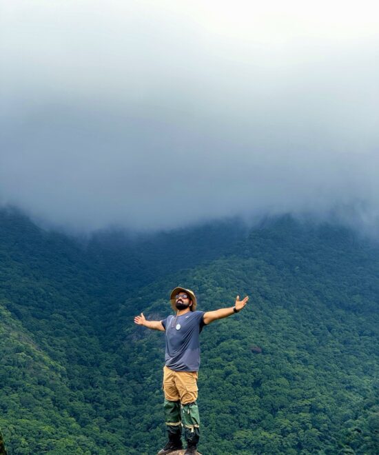
Today, much of the landscape associated with the route lies within or close to the protected wilderness of Silent Valley National Park in Kerala and the high Nilgiri landscapes towards Mukurthi in Tamil Nadu.
But the story of Sispara did not begin with the British.
It began much earlier, when people on either side of the Western Ghats already knew how to cross these mountains.
Where Was Sispara Ghat?
Sispara lies along the western edge of the Nilgiri plateau, where the high mountains fall sharply towards the Malabar plains.
The historic route is associated with places recorded as:
Sholakul → Walaghat → Sispara → Avalanche → Ootacamund
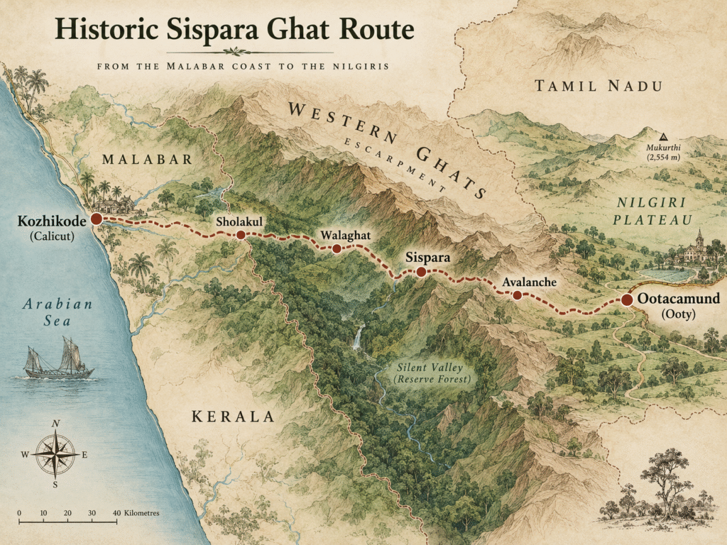
Travellers’ bungalows once existed at Sholakul, Walaghat, Sispara and Avalanche.
Calling it a “road”, however, can be misleading.
Parts closer to the Nilgiri plateau could accommodate lightly loaded carts, but much of the difficult descent below Sispara was closer to a mountain path or bridle trail.
This was not a nineteenth-century version of a modern ghat highway.
For long stretches, travelling through Sispara meant walking through some of the steepest and wettest terrain in the Western Ghats.
Long Before the British, People Were Already Crossing These Mountains
The British did not discover a completely unknown passage.
Communities living in Malabar and the Nilgiris had interacted long before colonial surveyors arrived.
Badagas and Todas lived in the Nilgiri highlands, while trade and communication connected the plateau with areas towards Malabar.
One of the earliest written glimpses of this world comes from 1603.
That year, Jesuit priest Giacomo Fenicio travelled from the Malabar side towards the Nilgiris.
His destination was described as Todamala, associated with the land of the Todas.
Fenicio reached the Nilgiri highlands with local help and recorded encounters with both Todas and Badagas.
His journey reveals something easy to forget today:
The Western Ghats were a barrier — but they were never an absolute boundary.
People knew routes through them.
Goods crossed them.
Languages crossed them.
Knowledge of passes, water sources and safe approaches passed between communities long before those paths appeared on British maps.
Did Fenicio actually cross Sispara?
We cannot say that with certainty.
His return journey is described as following an easier route shown by local Badagas, and the geography makes a western descent through the Sispara side an interesting possibility.
But the surviving evidence does not conclusively identify the route as Sispara Ghat.
So it is better treated as a possibility, not a fact.
What Fenicio’s journey does establish is more important:
Malabar and the Nilgiri plateau were connected long before the British tried to formalise those connections into roads.
The British Wanted a Faster Road to Ooty
By the early nineteenth century, Ootacamund — today’s Ooty — was becoming increasingly important to the British administration.
But getting there was difficult.
A route from the western side offered an attractive idea: connect the Nilgiris more directly with the Malabar coast and shorten the journey to the hills.
In 1831, Governor of Madras Stephen Rumbold Lushington supported development of the route that would become the Sispara Ghat road.
The objective was simple to describe and extremely difficult to achieve:
Create a practical connection between Calicut and Ootacamund across the Western Ghats.
Major Crewe, Lieutenant LeHardy and Captain W. Murray were among those associated with investigations of the western approaches.
They found an existing path.
The British plan was to turn it into something much more ambitious.
Sispara Ghat: A Short Timeline
1603 — Giacomo Fenicio travels from Malabar into the Nilgiris.
1831 — British authorities support development of a western route towards Ootacamund.
1832 — Major construction begins under Captain Murray and the Pioneer Regiment.
1838 — The Sispara route is considered complete.
1841 — It is already reported as rarely used outside the dry season.
1860 — Clements Robert Markham travels through Sispara from the Malabar side towards the Nilgiris.
Building a Road Where the Mountains Did Not Want One
Major work began in 1832.
Captain Murray and soldiers of the Pioneer Regiment were involved in clearing and developing the route.
Camps were established around Avalanche and Sispara.
Think about the conditions.
No excavators.
No modern retaining structures.
No motor vehicles.
No satellite weather forecasts.
Workers faced steep slopes, dense forest, heavy rainfall and wildlife.
And one detail from the road-building period sounds almost like a scene from an adventure novel.
Five Jingalls, Ten Armed Peons — and a Road Through Tiger Country
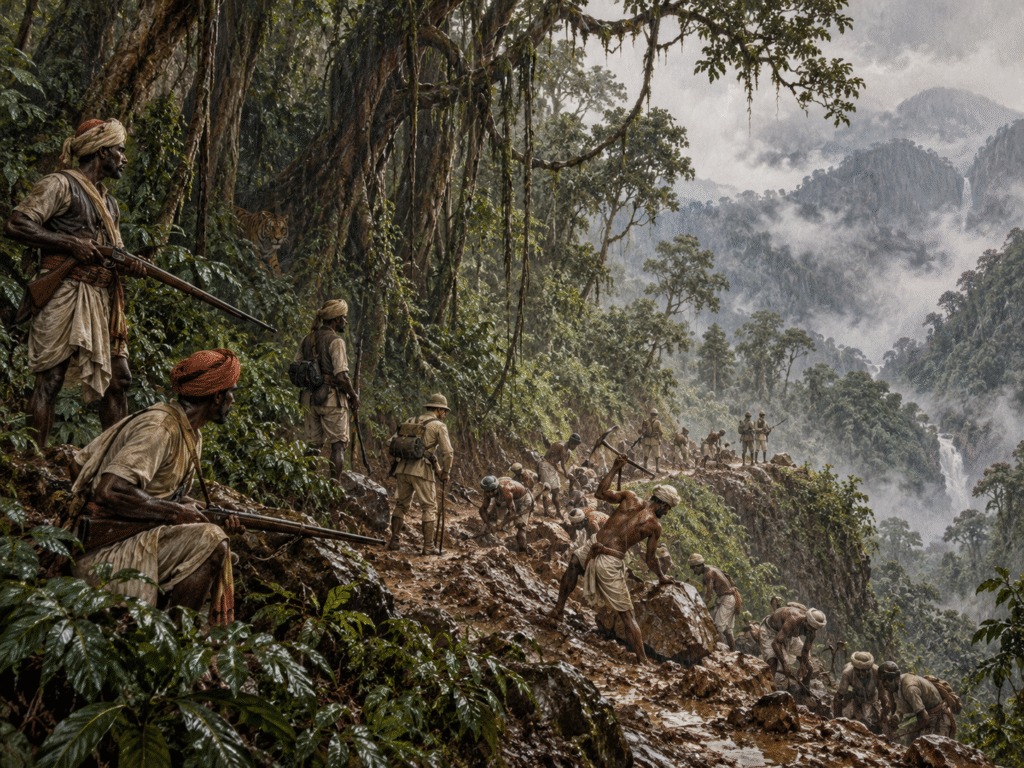
Elephants and tigers were considered enough of a threat that the Collector of Malabar received sanction for five large firearms known as jingalls and ten armed peons to protect workers.
Imagine the scene.
Road workers and Pioneer Regiment soldiers cutting a path through remote forest while armed guards watched for elephants and tigers.
Yet wildlife would not be what defeated Sispara.
The mountains would.
Walaghat and the “Ladder Hill”
One of the most difficult sections became known as Ladder Hill.
The slope was so severe that the route climbed through sharp zigzags.
At Walaghat, Pioneer camps were established in terrain so steep and confined that even creating a normal camp was difficult.
This was road engineering on the edge of an escarpment.
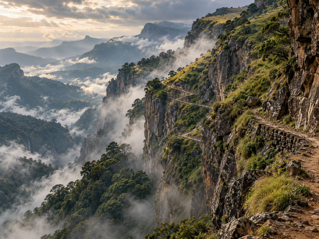
By 1838, the road was considered complete.
Some sections were described as having gradients of roughly 1 in 9.
Travellers’ bungalows stood at:
- Sholakul
- Walaghat
- Sispara
- Avalanche
The Sispara camp was even known for a time as Murraypet, after Captain Murray.
For a short while, the project must have looked like a success.
It connected worlds.
Then the monsoon arrived.
The Real Enemy Was Geography
Sispara sits in one of the harshest environments in the Western Ghats for maintaining a road.
Heavy monsoon rain battered the slopes.
Streams swelled.
Landslides damaged sections.
Vegetation returned quickly.
Repair work had to be repeated.
And travelling through the lower section remained physically demanding.
Porters were essential, but carrying loads across such terrain was exhausting work.
The dream of an easy Kozhikode–Ooty connection began to fall apart almost immediately.
By 1841, only a few years after completion, the route was reportedly rarely travelled except during the height of the dry season.
That fact alone tells the story.
A road that had required military labour, repeated engineering work, camps and travellers’ bungalows had become impractical within a few years.
Yet Travellers Still Came
Sispara did not disappear overnight.
In October 1860, British geographer and explorer Clements Robert Markham travelled from Calicut towards the Nilgiris through the route.
His journey gives us a glimpse of what crossing Sispara must have felt like.
From the humid Malabar plains, the path climbed through forest towards the cooler upper Nilgiris.
Near the escarpment, the landscape changed dramatically.
High grasslands and shola forests stretched behind.
Far below lay the plains of Malabar.
Nineteenth-century travellers repeatedly described the scenery around the route with admiration.
Anyone familiar with the western edge of the Nilgiris can understand why.
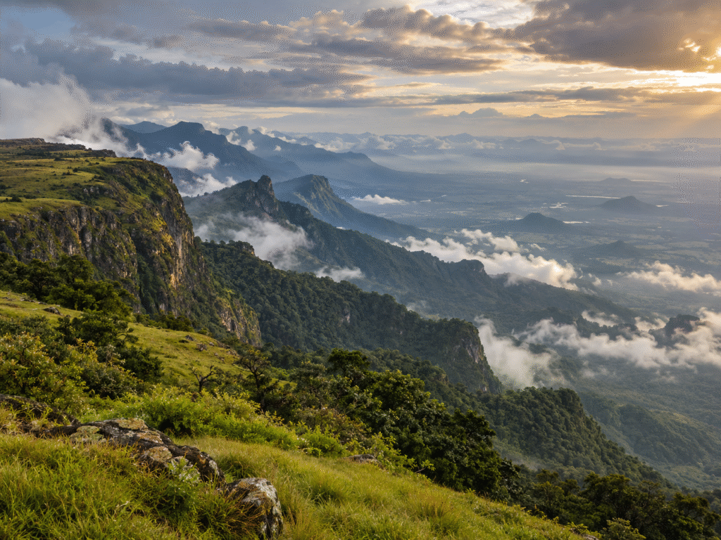
Few mountain roads could have offered a more spectacular approach.
Few could have been harder to maintain.
The Sispara Bungalow
One of the route’s best-known landmarks was the Sispara travellers’ bungalow.
In such an exposed landscape, shelter mattered.
Historical illustrations show buildings standing dramatically against the mountains around Sispara.
A nineteenth-century lithograph associated with Captain Stephen Ponsonby Peacocke depicts the bungalow landscape, while later records indicate structures remained in the area around 1857.
Sometime after that, the bungalow was reportedly destroyed in an accidental fire and was never rebuilt.
By then, the route was already losing importance.
The disappearance of the bungalow symbolised what was happening to the road itself.
And Then the Forest Returned
Humans had surveyed the route.
Soldiers had camped beside it.
Workers had carved zigzags into mountain slopes.
Bungalows had been constructed.
Travellers and pack animals had crossed it.
Then regular maintenance faded.
The monsoon returned.
Streams cut across the path.
Landslides erased sections.
Grass covered the open ground.
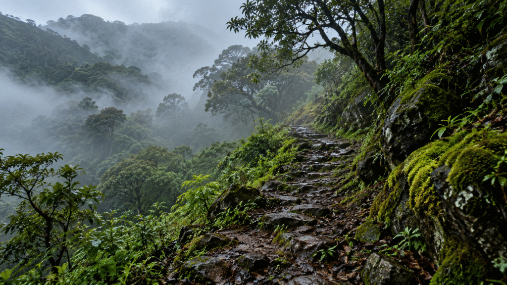
Forest swallowed the lower trail.
The road faded. The forest remained.
Slowly, a road built across the Western Ghats became part of the Western Ghats again.
From Road to Protected Wilderness
The landscape around the historic route has a very different meaning today.
On the Kerala side lies Silent Valley National Park, one of the most important remaining tropical evergreen forest landscapes in the Western Ghats.
Towards Avalanche and Mukurthi, the upper Nilgiris are characterised by high-elevation grasslands and shola ecosystems.
What colonial administrators once saw primarily as difficult terrain to be crossed is today recognised as an ecologically sensitive landscape that requires protection.
That transformation may be the most interesting chapter in the entire Sispara story.
The route was created to make the mountains easier to cross.
Today, some of those same mountains remain protected precisely because they have not been opened up in the same way as ordinary travel corridors.
Can You Trek Sispara Ghat Today?
This story naturally creates a question:
Can we walk the old route today?
Important: This Is a Protected Landscape
Sispara should not be treated as an ordinary trekking trail.
The historical alignment passes through or is associated with highly protected forest and national-park landscapes.
Old maps, historical route descriptions or remnants of a trail do not mean the route is legally open for trekking.
Access is controlled by the respective Forest and Wildlife authorities, and conditions can change.
Anyone visiting protected areas must follow current official permissions and regulations.
For most people today, Sispara is best understood not as another trail to conquer, but as a remarkable piece of Western Ghats history.
More Than a Forgotten British Road
Calling Sispara simply a “British road” also misses something important.
The colonial road existed for only a short period.
The connection between Malabar and the Nilgiris was much older.
Local communities knew how to move across these mountains before engineers arrived.
The British did not create the geographical relationship.
They tried to formalise it.
And for a few years, they succeeded.
But Sispara ultimately demonstrated something that anyone who spends time in the Western Ghats eventually understands:
the landscape sets the rules.
A Road the Western Ghats Reclaimed
In the 1830s, engineers looked at Sispara and imagined a dependable road between Malabar and the Nilgiris.
They surveyed it.
Cut it.
Levelled it.
Protected the workers.
Built shelters.
And sent travellers across it.
Then came rain.
Landslides.
Vegetation.
Fire.
And time.
What remains today is not the road they imagined, but the landscape that was always there.
A road built to cross the Western Ghats was ultimately reclaimed by the Western Ghats.
And perhaps that is why the forgotten story of Sispara is still worth telling.
Responsible Travel Note
Sispara and the surrounding Silent Valley–Nilgiri landscape include ecologically sensitive and legally protected areas.
This article explores the history and geography of the old Sispara Ghat. It is not a trekking guide and should not be interpreted as encouragement to enter restricted forests.
Always follow official Kerala and Tamil Nadu Forest/Wildlife Department regulations and use only permitted tourism and trekking routes.
Acknowledgement
This article was inspired in part by the historical account and field observations shared by N. S. Sujin about the forgotten Sispara/Kundah Ghat route.
Where historical evidence does not establish a claim conclusively — particularly regarding Giacomo Fenicio’s possible connection with Sispara — it has been presented as a possibility rather than established fact.
References & Further Reading
Further historical material on Sispara can be found in Nilgiri district histories, nineteenth-century travel writing and records concerning the development of early routes across the Nilgiris.
Useful starting points include:
- A Manual of the Nilagiri District in the Madras Presidency
- Writings associated with Clements Robert Markham’s travels through the region
- Historical accounts of early European travel into the Nilgiris
- Official Kerala and Tamil Nadu Forest/Wildlife Department information for current protected-area regulations